
Of Infrared Expertise
Plus Alaska & Puerto Rico
Not Drones
For Facility Decision-Makers
An aerial wildlife survey uses aircraft-mounted infrared sensors to detect, count, and map warm-bodied animals across broad study areas. Wildlife produces thermal contrast against the surrounding ground, allowing AITscan to capture and georeference detections under suitable survey conditions.
AITscan can use this approach for multiple wildlife applications, but much of the company’s work focuses on white-tailed deer and other cervid populations. The resulting dataset can support population estimates, distribution mapping, density analysis, and long-term monitoring across management units, research areas, and other landscapes.
The data is designed to support wildlife agencies, environmental consultants, land managers, and research programs that need consistent documentation for population management, agency reporting, environmental review, or peer-reviewed research.
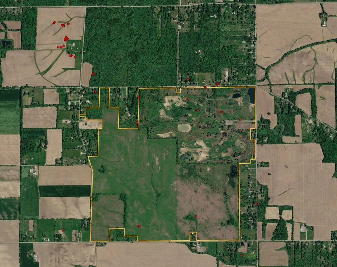
Ground-based observation and short-range platforms can work well for small, defined study areas. For management units, research landscapes, and other broad survey areas, an aerial wildlife survey can provide more consistent coverage within a single biological and atmospheric window.
AITscan can collect wildlife detections across the full study area during one coordinated flight, helping reduce variation caused by changing weather, animal movement, light conditions, or survey timing. That consistency can improve population mapping, density analysis, and comparisons across different habitat blocks.
Aircraft-based thermal imaging is especially useful during cool-season, pre-dawn survey windows when warm-bodied wildlife can produce stronger thermal contrast against the surrounding landscape. Survey timing is planned around the target species, regional conditions, and the biological objectives of the program.
For agencies and researchers, the value is not simply broader coverage. A consistent, georeferenced wildlife dataset can support population estimates, management decisions, environmental review, and long-term monitoring across repeated survey cycles.
Wildlife programs depend on population estimates, harvest quotas, mitigation requirements, environmental findings, and long-term management plans. When the underlying count is incomplete or inconsistent, every downstream decision carries more uncertainty. Daylight visual counts can miss animals in cover-rich landscapes, while ground transects can become difficult and expensive to scale across a full management unit.
An aerial wildlife survey gives agencies, consultants, and research teams a broader population dataset collected under coordinated biological and atmospheric conditions. That consistency can strengthen population estimates, distribution mapping, density analysis, and comparisons across repeated survey cycles.
The value is not limited to the count itself. Better population data can support harvest management, mitigation planning, habitat decisions, environmental documentation, and stakeholder discussions. When a program’s conclusions are challenged, a current georeferenced thermal dataset provides a documented record of how the population assessment was developed.
Repeating aerial surveys over time can make the dataset even more useful. A consistent survey cadence allows wildlife managers and researchers to compare population distribution and density across years without relying on a patchwork of unrelated survey methods. That longitudinal record can strengthen agency reporting, research programs, funding decisions, and long-term management planning.
For environmental programs that also involve utility-scale renewable development, AITscan provides solar field infrared surveys for operational inspection of utility-scale PV assets.