Of Infrared Expertise
Plus Alaska & Puerto Rico
Not Drones
For Facility Decision-Makers
CityScan IR is AITscan’s aircraft-based municipal thermal mapping service for cities and utility operators managing underground steam, hot-water, chilled-water, and other buried distribution systems. Thermal anomalies at the ground surface can reveal suspected heat loss and other conditions that warrant closer investigation across a city service area.
AITscan georeferences those findings to the utility network so operations and engineering teams can compare suspected anomalies against GIS data, distribution drawings, and known infrastructure. Instead of relying only on complaints or isolated inspections, CityScan IR provides a broader thermal view that can support maintenance prioritization, capital planning, and system documentation.
For municipalities that operate steam or district-energy systems, AITscan also provides dedicated underground steam leak detection and high temperature hot water leak detection services when a more system-specific survey is appropriate.
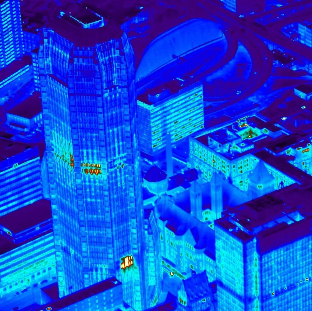
Ground-based thermography and short-range platforms can work well for isolated blocks, vaults, or known problem areas. For a citywide infrared survey covering miles of underground steam, hot-water, chilled-water, and other utility infrastructure, aircraft-based collection can provide broader coverage within a coordinated thermal window.
CityScan IR allows AITscan to capture thermal data across an entire municipal service area during the same mission, helping create a more consistent dataset for comparison across streets, utility corridors, vaults, and distribution segments. That consistency is especially valuable when engineering teams are evaluating anomalies across a network rather than investigating a single known issue.
Aircraft-based municipal thermal mapping can also reduce the need for repeated ground access across occupied downtown areas, busy streets, and other locations where inspection logistics may be difficult. The initial survey can help identify suspected thermal anomalies without requiring excavation, lane closures, or interruption of normal utility operations.
Once the findings are georeferenced against the utility GIS, operations and engineering teams can use the data to prioritize field verification, maintenance, and capital work across the network. For cities that need more system-specific follow-up, AITscan also provides underground steam leak detection and high temperature hot water leak detection services.
Aging municipal steam, hot-water, and chilled-water networks can lose a meaningful amount of energy before the problem becomes visible at the surface. The current page cites distribution losses of 15% to 25% on aging systems, and even one uninspected segment can contribute to major annual operating losses.
Municipal thermal mapping gives city operations and engineering teams a clearer picture of where suspected losses are concentrated across the network. Instead of relying only on complaints, emergency calls, or isolated inspections, CityScan IR creates a georeferenced thermal dataset that can support verification, maintenance prioritization, and capital planning.
The financial impact extends beyond fuel or utility loss. Underground failures in dense urban areas can trigger emergency excavation, traffic disruption, pavement restoration, service interruption, contractor mobilization, and unplanned labor. Identifying a developing problem before it becomes a visible failure can give the city more control over when and how repairs are made.
The data can also strengthen regulatory and budget discussions. A citywide thermal record tied to GIS provides engineering teams with documented evidence that can support capital requests, rate-base reporting, infrastructure planning, and long-term system management. For operators that repeat the survey on a regular cadence, the resulting history can show how the network is changing over time.
For municipalities managing broader underground infrastructure, AITscan also provides pollution and sewer leak detection to help identify thermal anomalies associated with water-management and receiving-water concerns.