Utility-Scale Solar Inspection

Solar Field Infrared Surveys for Utility-Scale PV

AITscan uses aircraft-based infrared surveys to identify module, string, and combiner-box thermal anomalies across utility-scale solar fields.

37+ Years

Of Infrared Expertise

50 States

Plus Alaska & Puerto Rico

Aircraft

Not Drones

Engineered

For Facility Decision-Makers

What Is Aerial Solar Field Infrared Inspection?

Aerial solar field infrared inspection is a non-destructive method that uses aircraft-mounted thermal imaging to identify temperature anomalies across utility-scale photovoltaic arrays. These anomalies can be associated with issues such as module hot spots, failed bypass diodes, string-level problems, junction-box faults, and combiner-box anomalies.

AITscan maps and georeferences these findings to the site or array layout so O&M, asset-management, and engineering teams can focus follow-up investigation on the modules, strings, or equipment that warrant attention. The resulting dataset can support maintenance dispatch, performance review, warranty documentation, and portfolio-level asset planning.

Aircraft-based collection is especially useful for utility-scale sites and multi-site portfolios because it allows broad areas to be inspected within coordinated irradiance and atmospheric conditions, creating a more consistent thermal dataset across the surveyed asset. For geographically distributed solar assets, AITscan can also support broader portfolio assessment through AreaScanIR.
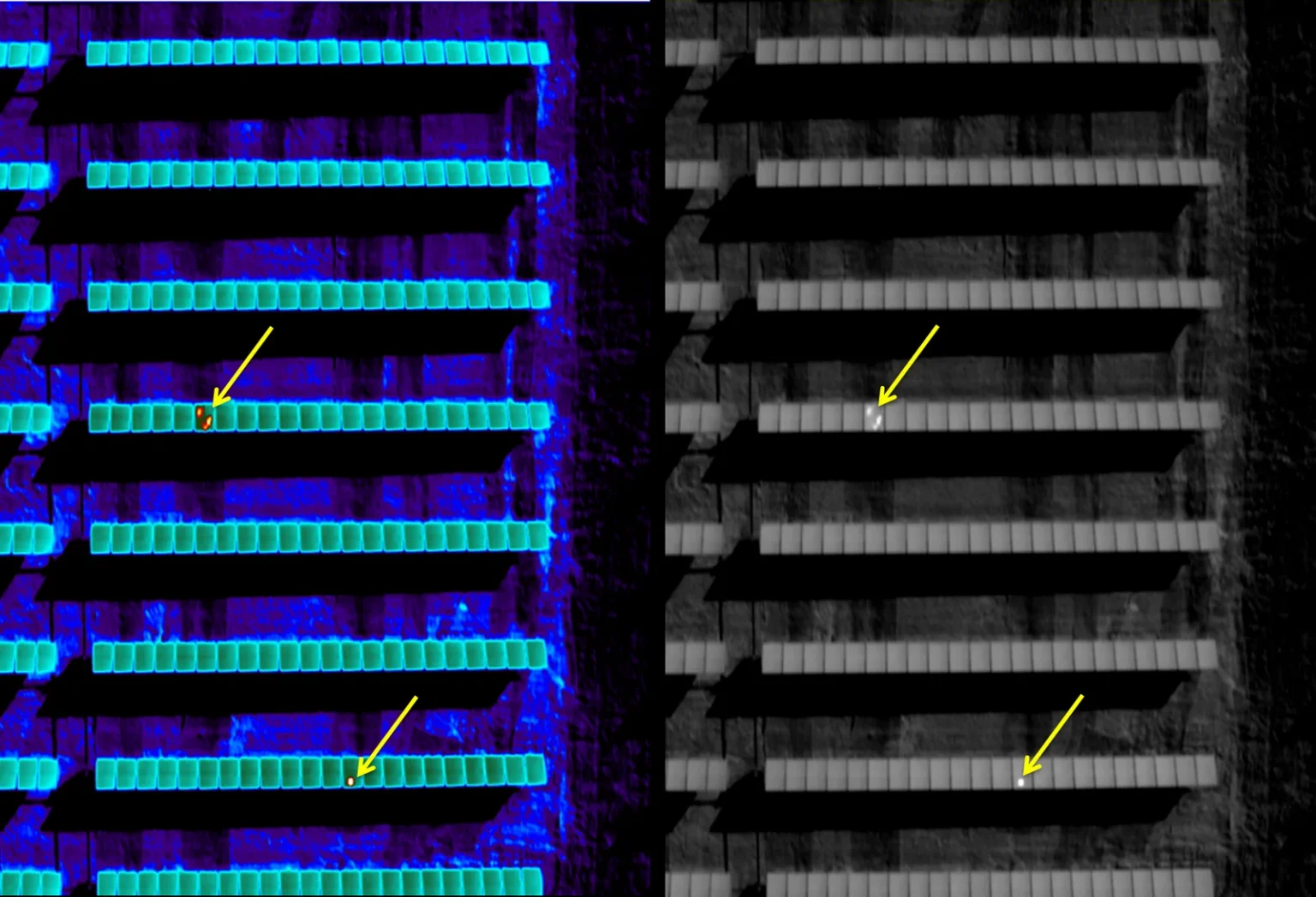
Solar field infrared survey showing thermal anomalies and hot spots across modules in a utility-scale PV array

What a Solar Infrared Survey Delivers

Module-Level Thermal Mapping
Thermal anomalies across modules, cells, strings, and related components are mapped and georeferenced for targeted follow-up.
String & Combiner Diagnostics
AITscan identifies suspected string-level and combiner-box anomalies that may warrant troubleshooting beyond inverter or SCADA data.
O&M-Ready Reporting
Reports organize thermal findings, locations, and defect classifications to support maintenance dispatch, asset reporting, and warranty documentation.

Built for Utility-Scale Solar Operators

Asset Managers
AITscan helps solar asset managers identify thermal anomalies across utility-scale PV portfolios for targeted follow-up.
O&M Teams
AITscan supports O&M teams with aerial infrared data that helps prioritize field inspection, troubleshooting, and maintenance.
Utilities & Cooperatives
AITscan helps utilities evaluate thermal anomalies across large solar fields and geographically distributed assets.
EPCs & Developers
AITscan provides thermal survey data that can support commissioning review, warranty documentation, and asset handoff.

Why Use Aircraft for Utility-Scale Solar Field Infrared Surveys?

Drone and ground-based thermography can work well for smaller solar sites or targeted inspections. For utility-scale solar fields and multi-site portfolios, aircraft-based infrared surveys can provide broader coverage while collecting the array within a coordinated irradiance and atmospheric window.

AITscan can survey an entire utility-scale site—or multiple nearby sites—during a planned flight period, helping create a more consistent thermal dataset across modules, strings, and related equipment. That consistency matters when asset managers need to compare anomalies across thousands of modules or evaluate performance across an entire portfolio.

Aircraft-mounted infrared sensors also allow AITscan to collect thermal data efficiently across extensive PV assets without relying on repeated short-range sorties. Survey timing, irradiance, atmospheric conditions, acquisition altitude, and experienced thermographic interpretation all contribute to the quality of the resulting data.

For O&M and asset-management teams, the advantage is not simply faster collection. A consistent, georeferenced thermal dataset can make it easier to prioritize field verification, compare defects across the array, support warranty documentation, and make better-informed maintenance decisions.
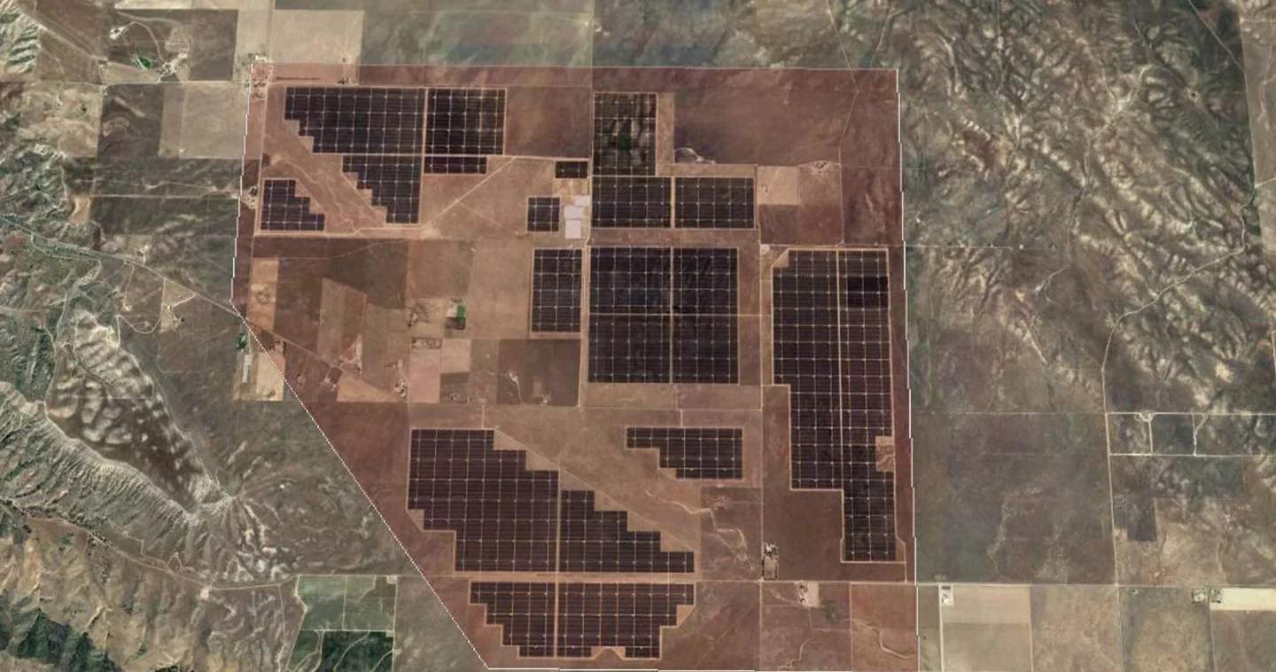
Aerial view of a utility-scale solar field surveyed with aircraft-based infrared thermography

How an Aerial Solar Survey Works

01
Initial Conversation
A short scoping call to review the site, installed capacity, module technology, known performance issues, and project goals.
02
Technical Net Meeting
AITscan meets with O&M, asset-management, and engineering teams to review the survey methodology, deliverables, and reporting requirements.
03
Scheduled Aerial Survey
The flight is scheduled around suitable irradiance and atmospheric conditions, with site coordination and flight planning handled in advance.
04
Analysis & Defect Reporting
Thermal imagery is processed, georeferenced, and classified into a defect inventory that supports field verification, maintenance dispatch, warranty review, and asset planning.

The Cost of Undetected Solar Defects

Utility-scale solar assets are revenue-producing infrastructure, and undetected thermal defects can translate directly into lost generation. String-level faults, failed bypass diodes, combiner-box issues, hot spots, and other anomalies can reduce output before the problem becomes obvious in higher-level performance data.

Aerial infrared surveys give asset managers and O&M teams a site-wide defect inventory that helps prioritize the issues with the greatest potential operational impact. Instead of relying only on inverter telemetry or waiting for monthly performance reports to reveal a broader problem, teams can use georeferenced thermal findings to direct field verification and maintenance more efficiently.

The financial impact can extend beyond recovered generation. Warranty periods often create important decision points for module and equipment owners, and documented thermal findings can help support end-of-warranty inspections, manufacturer discussions, and asset records. A survey performed before a warranty deadline may help identify defects while corrective options are still available.

For multi-site portfolios, consistent thermal data can also improve long-term asset management. Comparing defect patterns across sites can help operators prioritize maintenance budgets, identify recurring equipment issues, and create stronger documentation for refinancing, resale, audits, or future capital planning.

In some portfolios, recovering generation from a relatively small number of significant defects can offset a meaningful portion of the survey cost, while the value of properly documented warranty issues can increase the financial return further.

Frequently Asked Questions

A solar field infrared survey can include georeferenced thermal imagery, mapped module and string anomalies, defect classifications, and location-specific findings to support field verification, O&M planning, and warranty documentation. Explore AITscan’s aerial infrared services for additional inspection applications.
A solar field infrared survey can identify thermal anomalies associated with module hot spots, failed bypass diodes, string-level issues, junction-box faults, combiner-box problems, and other defects that produce a detectable thermal signature.
Aircraft are well suited for utility-scale solar fields and multi-site portfolios because they can collect broad areas within coordinated irradiance and atmospheric conditions, creating a more consistent thermal dataset across the surveyed asset.
Accuracy depends on irradiance, weather, system operation, sensor capability, acquisition conditions, and experienced interpretation. When those factors are properly controlled, infrared thermography can identify thermal anomalies that help O&M teams determine where field verification and troubleshooting should be focused.
Solar infrared inspections may be useful during commissioning, routine O&M, performance investigations, before warranty expiration, or when asset managers need a broader condition assessment across a site or portfolio.
Survey duration depends on site size, geography, installed capacity, and environmental conditions. Aircraft-based collection allows AITscan to efficiently inspect utility-scale solar fields and, where practical, multiple nearby sites within coordinated flight windows.

Ready to Evaluate Your Solar Field?

Talk with AITscan about your site, portfolio, and inspection goals to see how a solar field infrared survey can support O&M, warranty review, and asset planning.