
Aerial Roof Thermal Imagery, Licensed by Area

License archived or newly collected aerial infrared roof imagery by city, region, campus, or site for roofing, engineering, and facility planning.

Aerial Infrared Roof Imagery Built Over Decades

AreaScanIR™ is the licensable imagery side of AITscan’s aerial roof inspection work. Over decades of aircraft-based scanning, AITscan has built an extensive archive of aerial infrared roof imagery covering metropolitan areas, university campuses, school districts, industrial corridors, and other commercial roof portfolios across the United States.

Roofing consultants, manufacturers, engineering firms, and facility owners can license archived imagery by city, region, campus, or specific site. If the required area is not already in the archive, AreaScanIR™ can also support new aerial collection using the same aircraft-based thermal imaging workflow used for AITscan roof surveys.

The resulting imagery can support engineering specifications, capital planning, warranty review, roof replacement planning, and GIS workflows. For projects that require a full moisture-focused inspection rather than imagery licensing alone, AITscan also provides aerial infrared roof scanning.
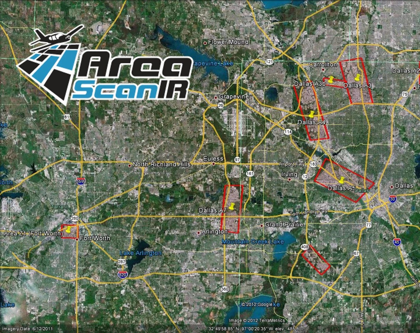
AreaScanIR™ aerial infrared roof imagery coverage map showing licensed survey areas across the Dallas-Fort Worth region

Why Roofing and Facility Teams License Imagery From AreaScanIR™

The Largest U.S. Archive
Decades of aerial infrared roof imagery cover many metropolitan areas, university campuses, school districts, and industrial corridors across the U.S.
Aircraft-Based Thermal Collection
AreaScanIR™ imagery is collected with aircraft-mounted infrared systems designed for broad-area roof surveys and consistent thermal acquisition.
Built for Engineering & Planning Workflows
Imagery is delivered in formats that support engineering specifications, capital planning, warranty review, consulting reports, and GIS workflows.

Frequently Asked Questions

AreaScanIR™ includes aerial infrared roof imagery captured by aircraft-mounted thermal sensors across commercial roofs, metropolitan areas, university campuses, school districts, and industrial corridors throughout the United States.
Imagery is licensed by area, including a region, city, campus, or specific site, with terms based on how roofing consultants, manufacturers, engineering firms, and facility owners plan to use the data.
AITscan can schedule a new aerial mission to collect imagery for the required site or region using the same aircraft, sensors, and analyst workflow used for existing AreaScanIR™ imagery.
AreaScanIR™ imagery can be delivered in formats compatible with engineering, GIS, capital-planning, and reporting workflows, with specific file formats and metadata scoped during the project.

Ready to License Aerial Infrared Roof Imagery?

Talk with AITscan about the city, region, campus, or site you need to evaluate and whether AreaScanIR™ archive imagery or new collection is the right fit.